GUILLAIN Charles Documents sur l’histoire, la géographie et le commerce de l’Afrique orientale. Première partie : Exposé critique. Deuxième partie : Relation du voyage d’exploration à la côte orientale d’Afrique, exécutée pendant les années 1846, 1847 et 1848 par le brick Le Ducouëdic.
VENDU
Paris, Arthus Bertrand, 1856
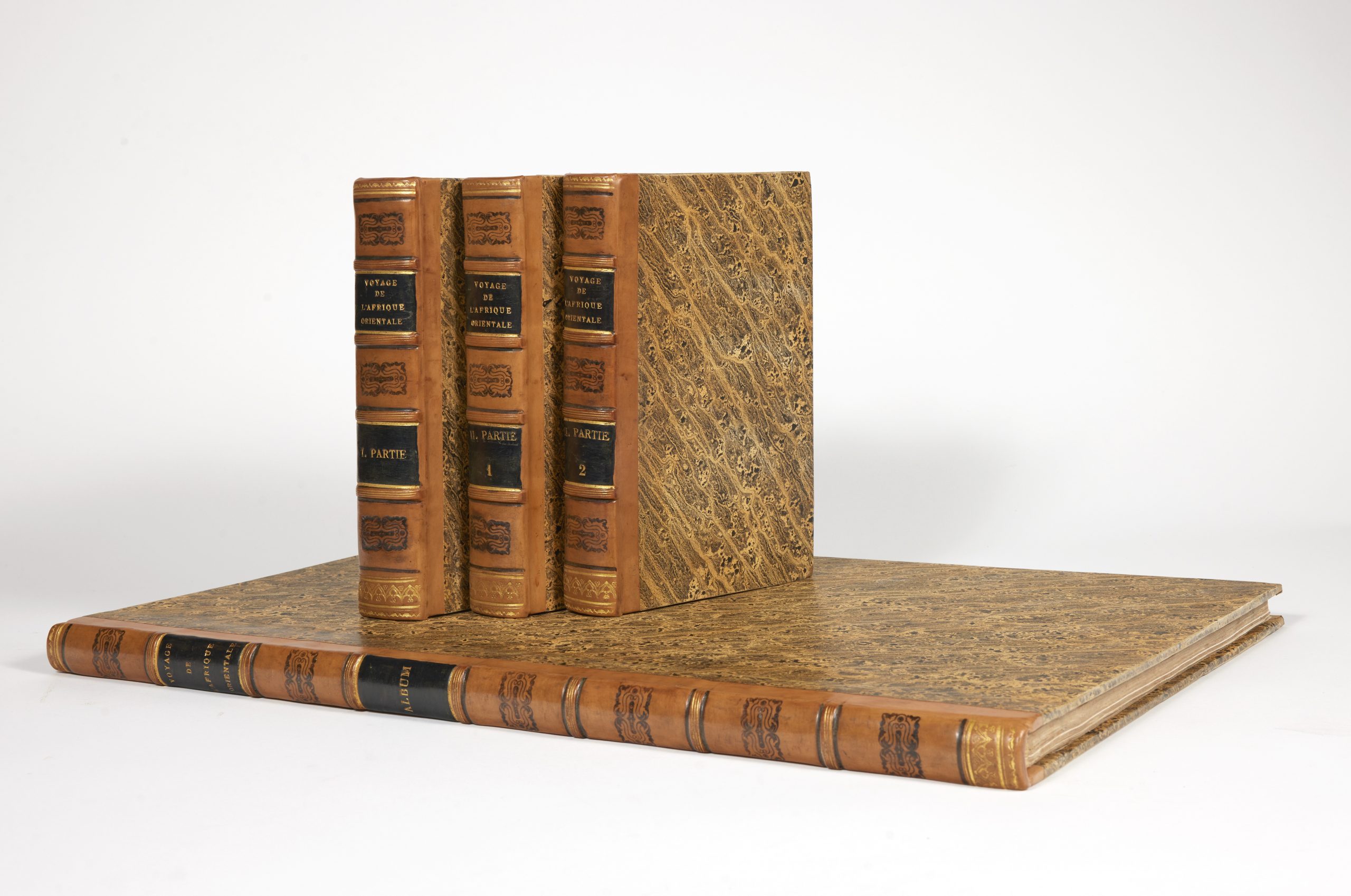
3 text volumes, 8vo (231 x 150 mm), and the atlas, folio (540 x 355 mm). Texte : Volume I : XXXI, 628 pp., 1 engraved plan, 1 typographical table. Part II / 1 : XXIII, 556 pp. Part II / 2 : 2 nn.ll., 527 pp. Atlas volume : 2 nn.ll., 55 engraved and numbered plates (including plate 27bis). Modern calf-backed boards bound in style, spines decorated.
The First Scientifc Exploration Documented by Photography
Gay, 236 & 2715 (erroneous collation for the atlas).
First edition.
Captain Charles Guillain (1808-1875) had published a study on the trade of Madagascar and its region in 1845. This work led the Ministry of Foreign Affairs and the Ministry of Trade to entrust him with the command of the Le Ducoëdic for a mission to explore the Indian Ocean coasts of Africa and the Portuguese settlements in India in order to study the commercial possibilities of this region. The voyage to explore the coasts of East Africa and India lasted from 1846 to 1848 and Guillain submitted his report in early 1850. The report of this voyage is a primary source for the study of these regions in the mid-19th century. Guillain was subsequently appointed member of a commission in 1858 to investigate new possibilities of French emigration to the colonies, and governor of New Caledonia in 1861.
First use of photography in a scientific voyage
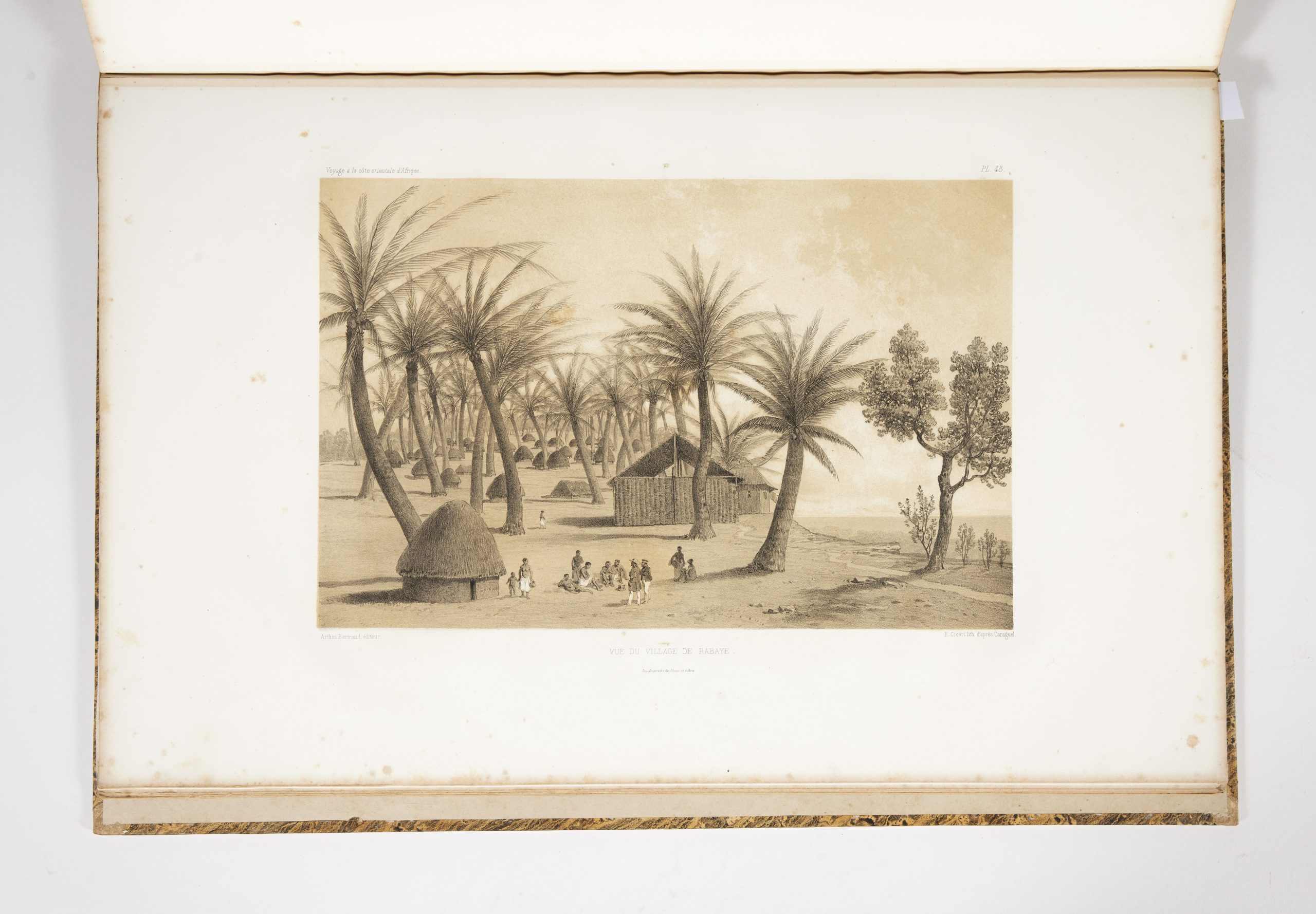
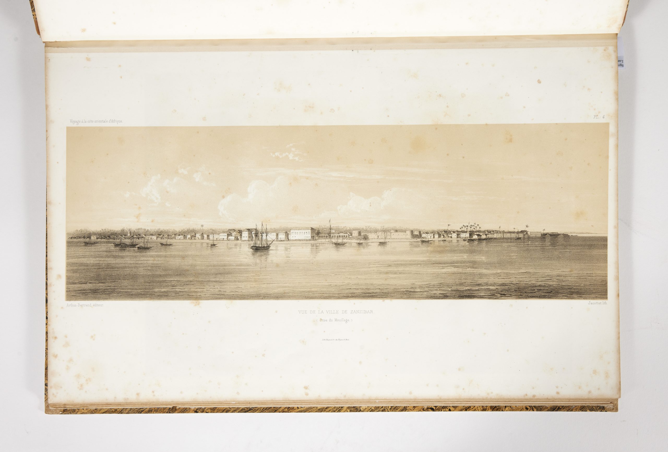
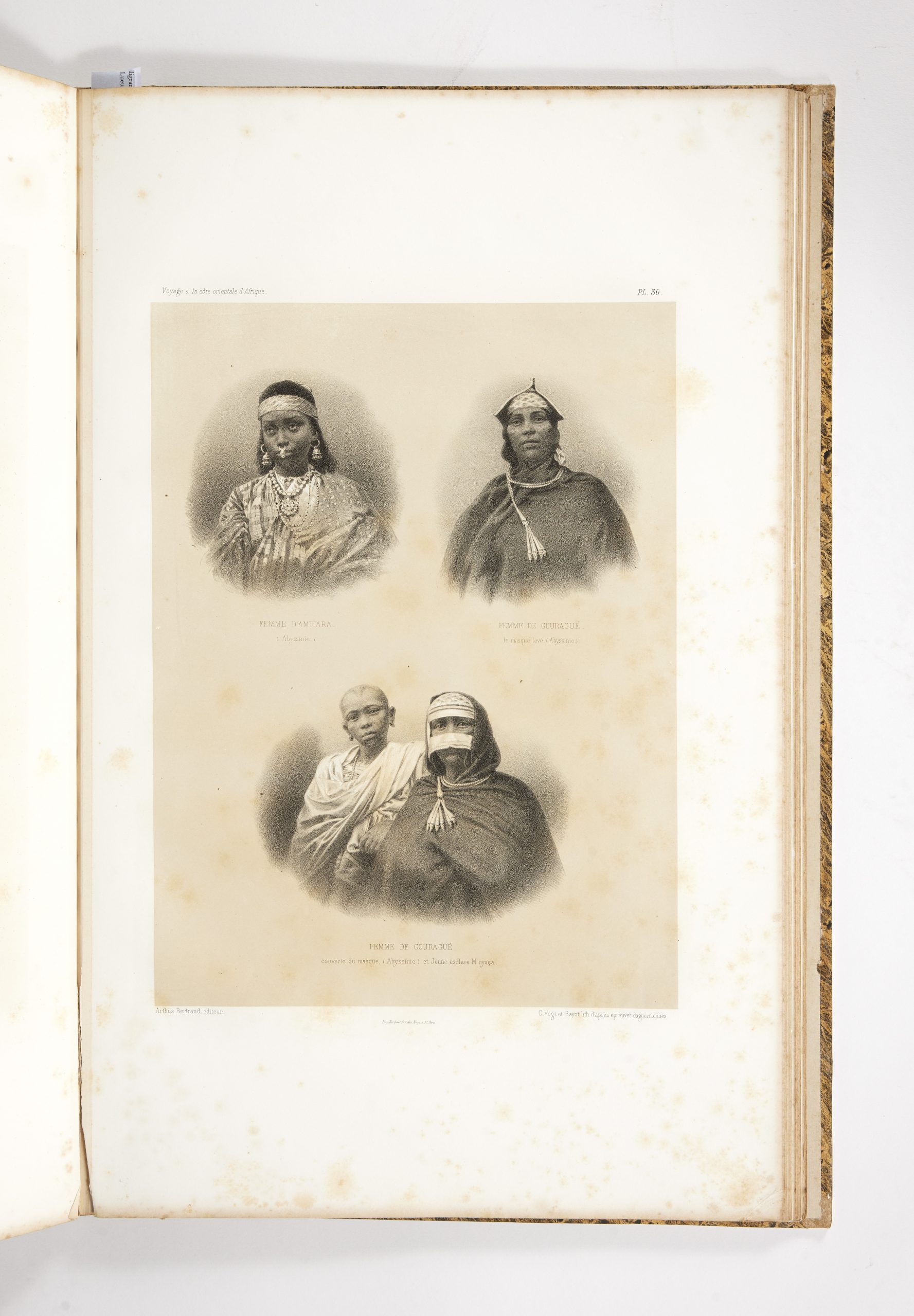
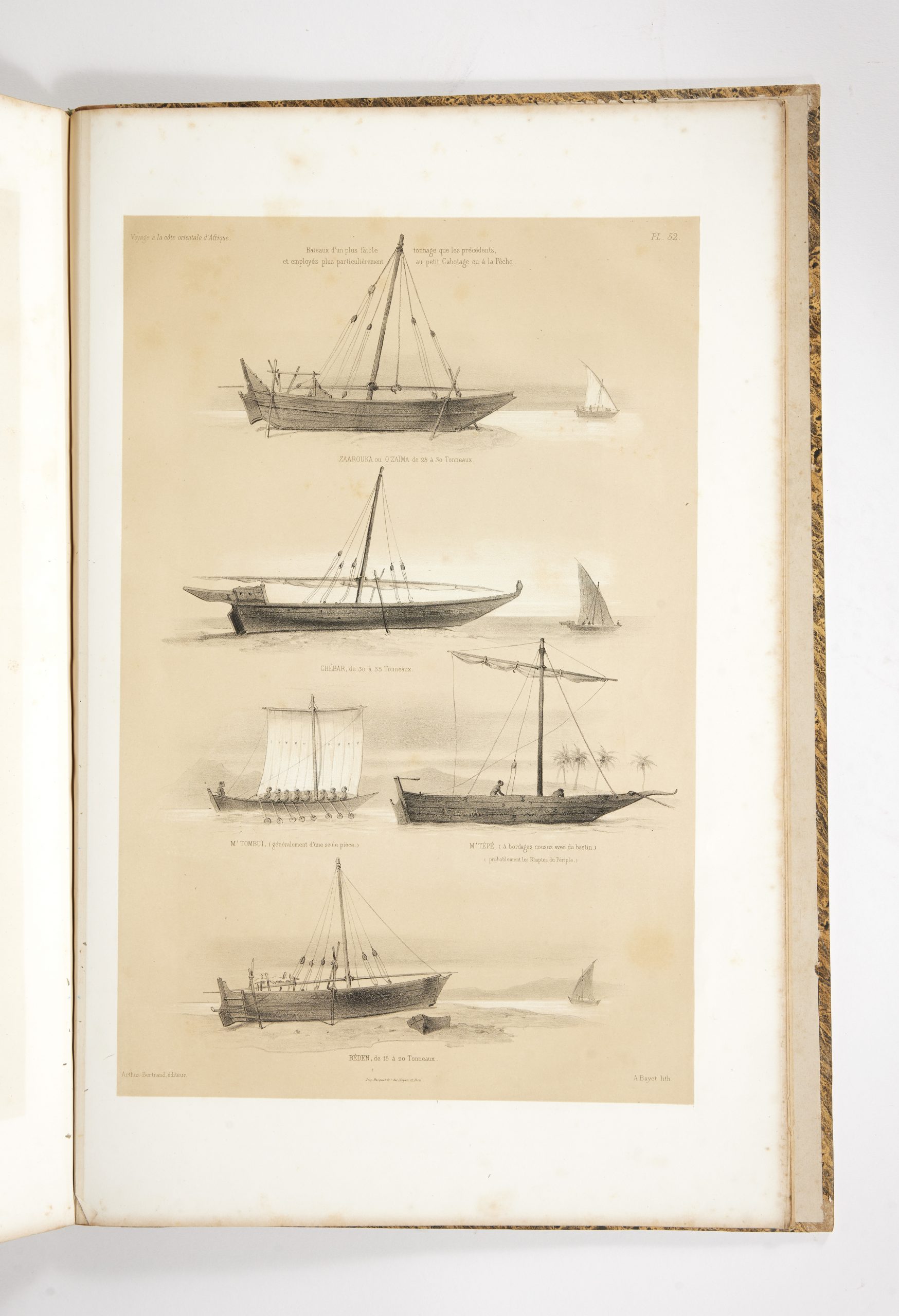
In addition to maps plans and view of Mombasa and Zanzibar, the atlas contains eighteen portrait plates of natives lithographed after daguerreotypes, all "collected in the course of the campaign", the others are from drawings by Caragule and Bridet. "[Guillain] est chargé de relever les côtes de l'Afrique orientale du 8e de latitude sud au 12e de latitude nord. Aux escales, Guillain et ses compagnons pénétrèrent dans l'arrière-pays pour étudier la géogrpahie physique et les populations Swhaili et Somali. Pour la première fois dans un voyage scientifique, la photographie est utilisée pour fixer les paysages et les types humains… La contribution de Guillain à la connaissance géographique, historique, ethnographique, économique de l'Afrique orientale est d'autant plus précieuse que les Français ne fréquentèrent guère ces parages" (Numa Broc, Afrique, p. 169).