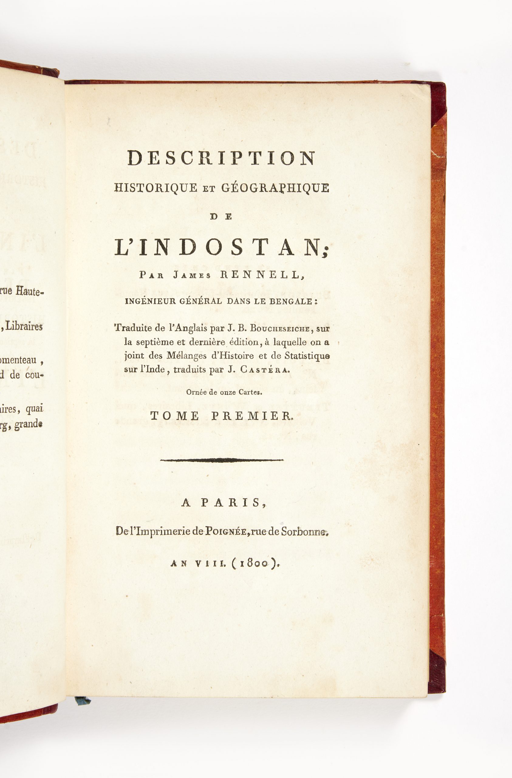
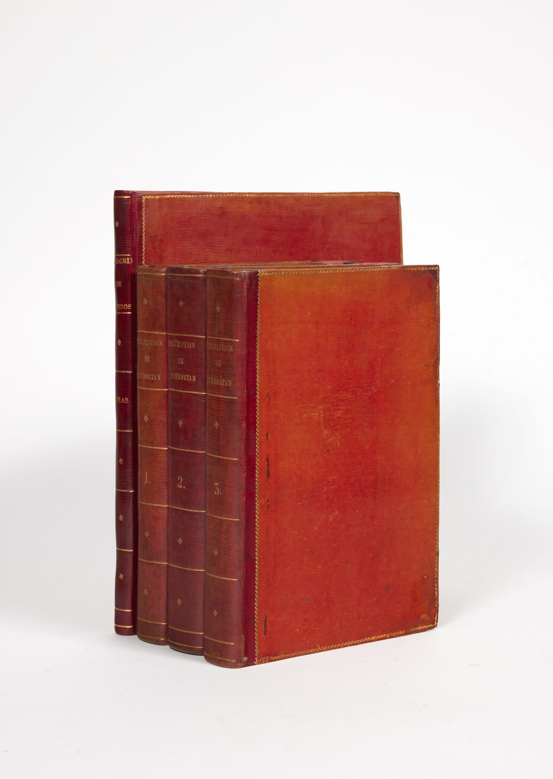
RENNELL James Description historique et géographique de l’Indostan. Traduite de l’anglais par J.B. Boucheseiche à laquelle on a joint des mélanges d’histoire et de statistique sur l’Inde, traduits par J. Castéra.
VENDU
Paris, Poignée, 1800
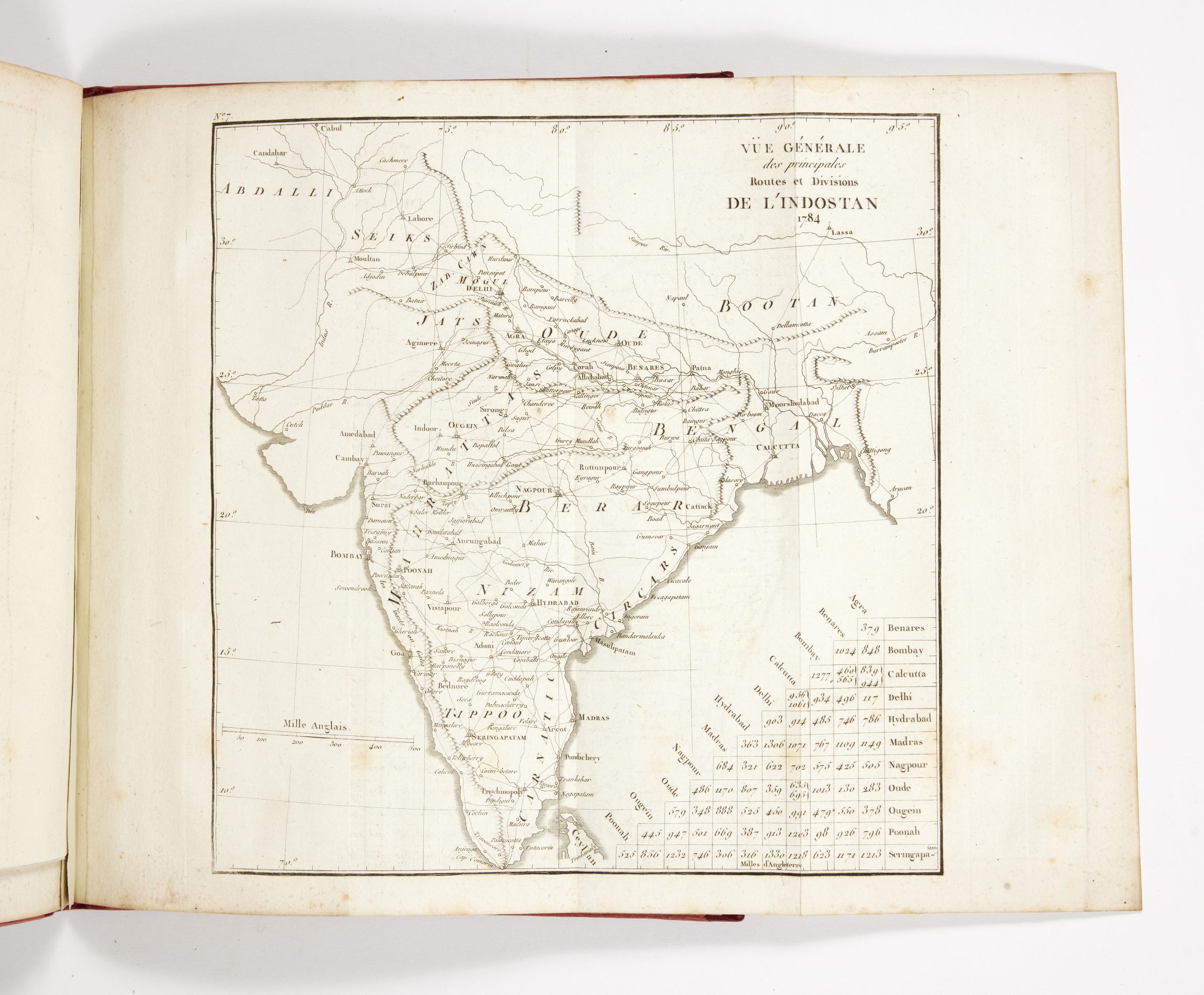
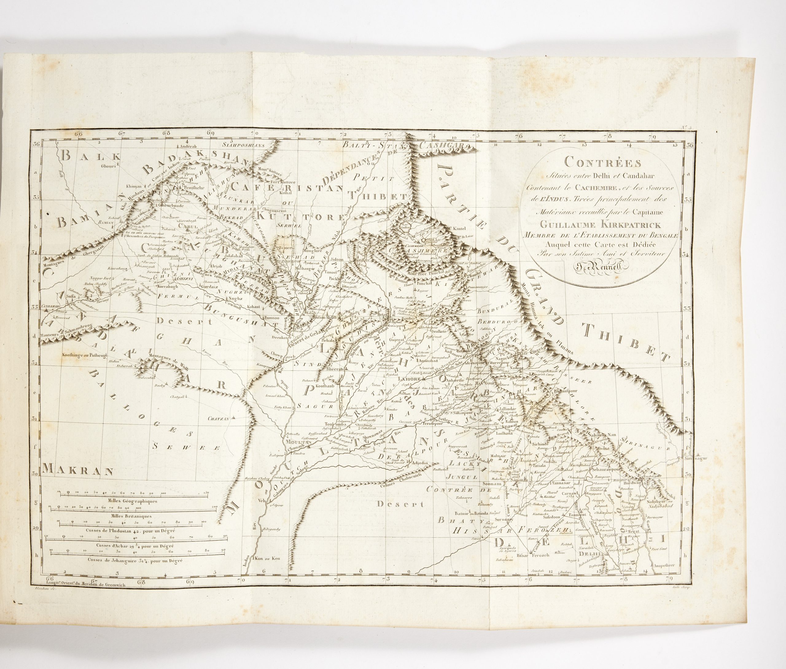
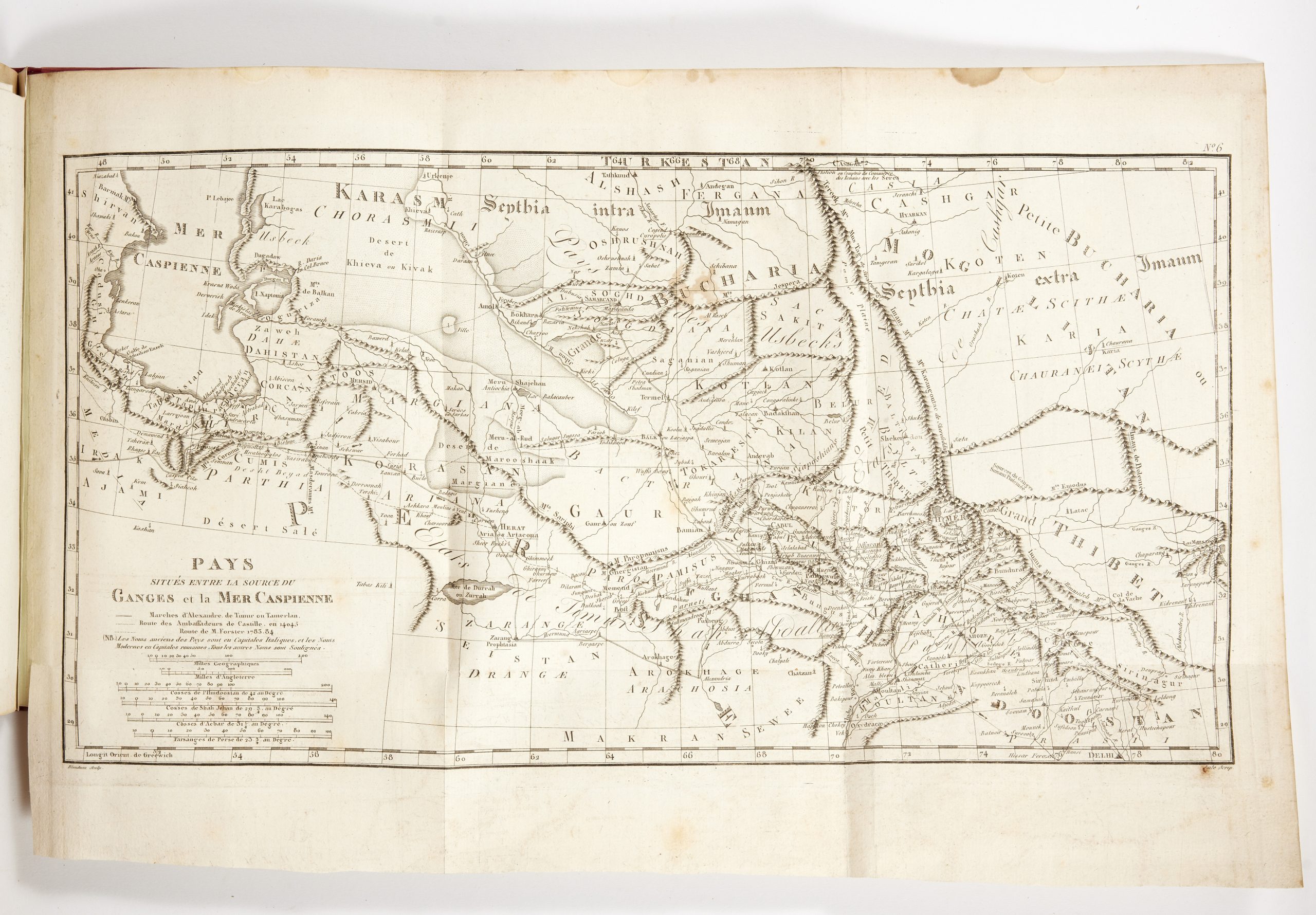
3 text volumes 8vo (220 x 137 mm) XXVIII, 302 pp. for volume I; 2 unn.ll., 410 pp. for volume II; 2 nn.ll. 462 pp. for volume III ; and one atlas volume 4to (270 x 222 mm) 39 pp., 11 engraved folding plates. Text bound in contemporary red morocco backed boards, flat spines gilt, atlas bound in style.
See Lowndes, III, 2071 (for the third English edition, 1793, "an invaluable work").
First edition of the French translation by Boucheseiche (there also was a pirated edition, published the same year in Leipzig). This translation is enriched with statistical details on India which are not found in the English edition.
"Les additions… contiennent de savantes recherches sur l'origine, les sciences et les arts des Indous, ainsi que des détails curieux sur quelques autres nations peu connues" (introduction, p. VII). James Rennell (1742-1830), historian, geographer, and oceanographer, created one of the earliest accurate maps of India and particularly of Bengal in his capacity as Surveyor General of that region. He was one of the founders of the prestigious Royal Geographical Society in London and is considered to be the father of the survey of India. The maps of the atlas were revised by Buache, and include Rendell's famous general map of India, "his second great work. the construction of the first approximately correct map of India" (DNB).
Having joined the navy in 1756, Rennell accompanied the geographer Alexander Dalrymple on his voyage to the Philippines in 1763, joined the East India Company in 1763, and then joined the Bengal engineers in April 1764. During his service, which lasted until 1777, he carried out work as a general surveyor. After his return to London in the same year he devoted his life to geographical studies and published important maps including the famous Atlas of Bengal (1779). A very good copy, complete with the rare atlas with the famous map of India in four large folding sheets.