Forbes, 569 ; Chadenat, 1196 ; Sabin, 73149 ; see Hill, 1483 (only for the abbreviated English edition 1823) ; O'Reilly, 100 ; Lada-Mocarski, 86 ; Numa Broc, Océanie, 341.
First edition.
The account by Camille de Roquefeuil (1781-1831) contains important information on the Marquesas Islands and California. This is the first XIXth century description of California. "Leaving Bordeaux on 18 October 1816, the ship Bordelais crossed the Atlantic diagonally to round South America… The French stayed in Peru for more than two months, and Roquefeuil painted a vivid picture of Creole society in Lima on the eve of independence… The Bordelais left Callao on 30 May for San Francisco, where his main mission began: to buy furs on the north-west coast of America and trade them in China for tea and silks. On 5 August 1817, Roquefeuil was the first French navigator to enter San Francisco Bay, then occupied by the Russians" (see Numa Broc).
After a long voyage via the Marquesas Islands, the Sandwich Islands and Macao, the Bordelais finally returned to France and anchored in Gironde on 23 November 1819 after an absence of 37 months.
"From a nautical and geographical point of view, the voyage was a success which paved the way, to a certain extent, for the circumnavigations of Freycinet and Duperrey" (see Numa Broc).
"The text has important chapters on California, the Northwest Coast, and Alaska. Hawaii was sighted on January 8, 1819, and the Bordelais remained in Hawaiian waters until the 6th of the month. The author visited the islands of Kahoolawe, Maui, Lanai, Molokai, and ultimately Oahu. Important remarks on Kamehameha appear in a long chapter on pages 339-343" (Forbes).
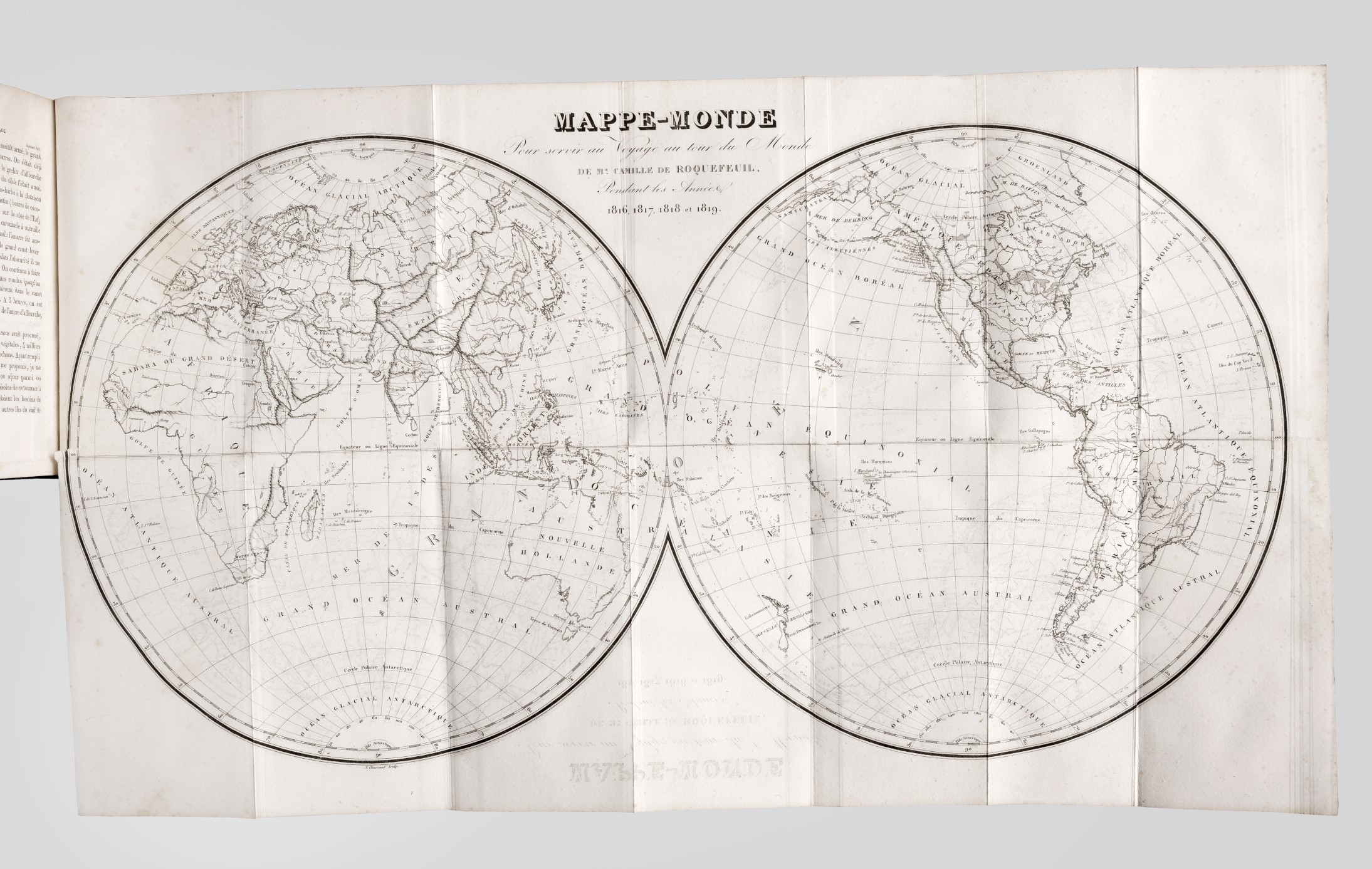
This copy is complete with its two important maps – one being a worldmap, the other with details on the North-West coast of North America (New Albion and California). The latter with old, restored tear and mounted sympathetically at the time.
A very good copy, from the library of General Vaudable (book plate).